
Scarborough Cleveland Way
Cloughton to Scarborough Coastal Walk – Cleveland Way Yorkshire Coast Trail
Follow the Cleveland Way from Cloughton to Scarborough on a stunning Yorkshire coastal walk. Enjoy dramatic sea cliffs, sweeping North Sea views, and peaceful woodland paths as you approach Scarborough’s historic seafront. A scenic and rewarding trail showcasing the best of the Yorkshire Coast.
About The Cleveland Way
The Cleveland Way National Trail is one of England’s most scenic long-distance walking routes, stretching for 109 miles through the breathtaking landscapes of the North York Moors National Park and along the dramatic Yorkshire coast. Beginning in the market town of Helmsley, the trail winds across open moorland, past ancient ruins and hilltop viewpoints, before reaching the coast at Saltburn-by-the-Sea. From there, it follows rugged sea cliffs and picturesque fishing villages, offering walkers a rich mix of countryside, heritage, and coastal scenery.
Whether you walk a short section or take on the entire route, the Cleveland Way offers an unforgettable outdoor experience. Highlights include Roseberry Topping, Whitby Abbey, Robin Hood’s Bay, and Scarborough Castle, each revealing a different aspect of Yorkshire’s natural and cultural beauty. The trail is well-marked and accessible for walkers of all abilities, with plenty of welcoming towns and villages along the way for rest and refreshment. Combining history, wildlife, and panoramic views, the Cleveland Way is one of the UK’s most rewarding long-distance walks.
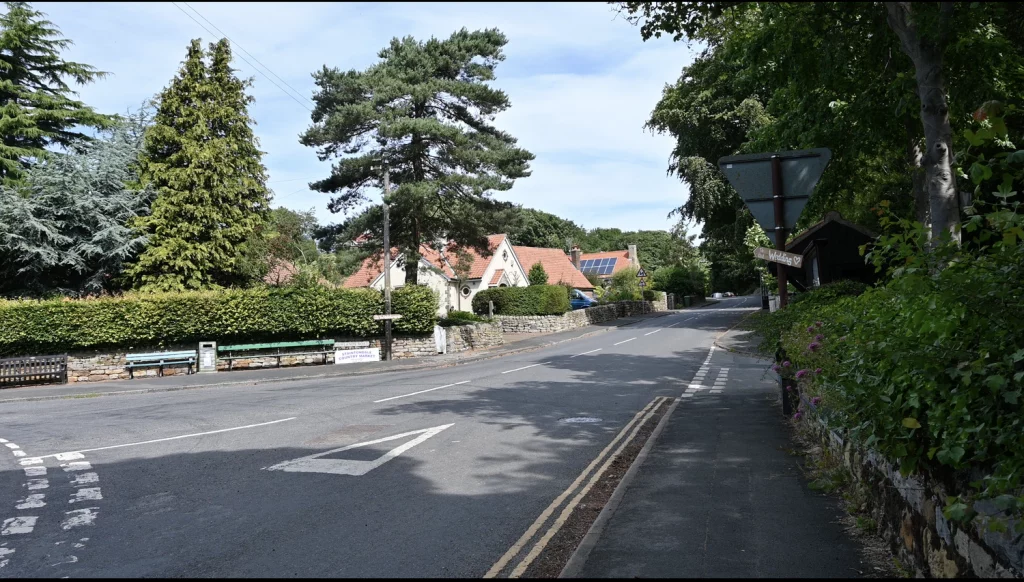
1. Starting Point Cloughton
From the main street in Cloughton, walk northwards along the A171 until the road bends to the left with a split. At the split, walk slightly up hill and find Newlands Lane on the right that heads down to the Yorkshire Coast.
Although the walk is relatively short in terms of distance, it does contain a few ascents. These are often stepped, and therefore this walk may not be for everyone.
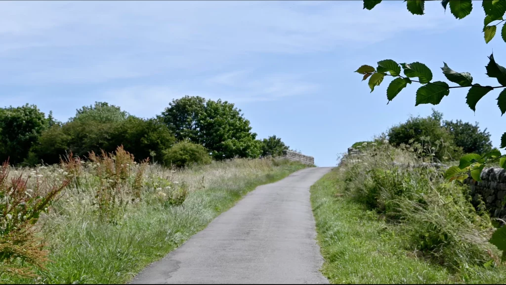
2. Cinder Path Bridge
Follow the bridge over Cinder Path and continue to down the lane (now Salt Pan Road) until you reach a small car park. You will see a signpost for the Cleveland Way. At this signpost, turn right.
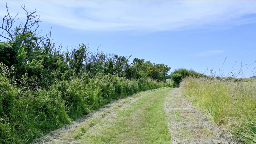
3. Turn Right on the Cleveland Way
From the signpost, follow the Cleveland Way Waling Trail back to Scarborough. Owing to the formation of the Yorkshire Coast, this will be hilly at times. Some of these descents and ascents have steps to make it easier.
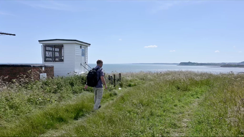
4. 1927 Coastguard Hut
You will eventually arrive at a historic Coastguard Hut from 1927 that was used to monitor the sea and lookout for any vessels in distress. Keep following the coast trail from here.
5. Intersection for Burniston
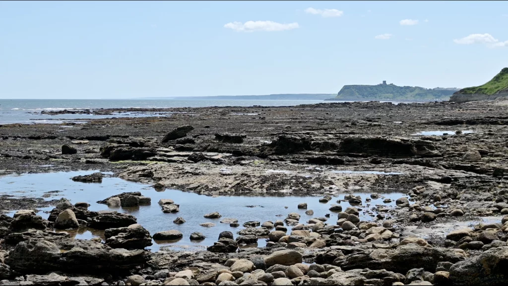
Eventually you will arrive at a intersection for Burniston. Taking the route straight on will take you back to Scarborough. Taking a right turn will bring you to Burniston. However, if you turn left, this will take you to a rocky beach providing that the tide is out. Please take care if you decide to examine the beach, and pay attention to the tide.
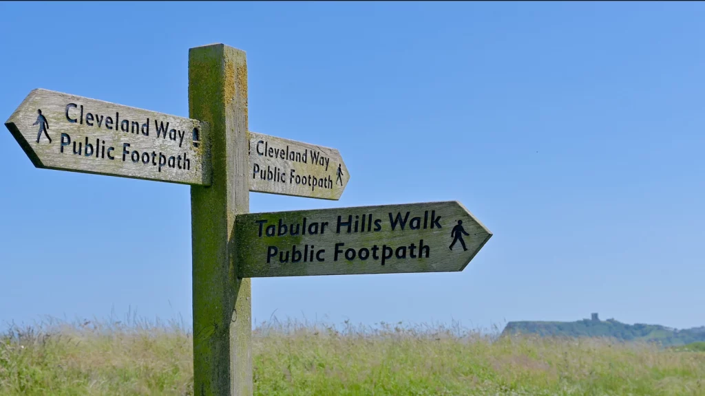
6. Tabular Hills Walk Intersection
Absorbing the sea views, you will encounter a signpost for the Tabular Hills Walking Trail which is a 48 mile route to Helmsley across the Tabular Hills. Ignore this signpost and continue following the coastal path until you reach Scalby Mills.
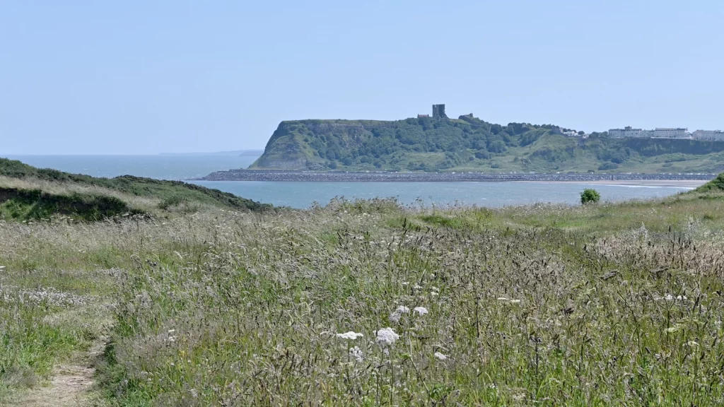
7. Scarborough Castle Views
Scarborough Castle is almost constantly in view throughout this trail, but by now it will be more prominent. This is a good marker to use along this walk to access how close you are to the finish.
All along this route, you may want to be vigilant and look out for porpoise (a type of dolphin) as well as bottle nose dolphin as they can often be spotted from the coast.
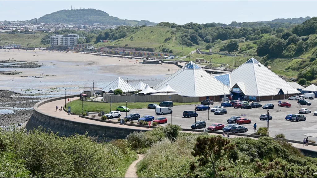
8. Follow Path to Scarborough Scalby Mills
As you descend towards Scarborough, you will see a footbridge over Scalby Beck (known as the Seacut). Cross the bridge towards the Scalby Mills Pub.
This brings us neatly to the North Bay of Scarborough where we complete our section of this walk. You may want to start this walk further away at Ravenscar or Robin Hood’s Bay. If you need to get a bus back to Cloughton, you can board a X93 or X94 outside the railway station. Alternatively, you may want to park in Scarborough and board the bus to Cloughton and walk back.
Useful Links
🥾 Trail & Route Information
AllTrails – Cleveland Way (trail segments list)
A breakdown of segments with user maps, reviews, and difficulty. AllTrails.com
National Trails – Cleveland Way: Route Description & Info
Official route overview and trail details. National Trails
North York Moors National Park – Cleveland Way National Trail
Information about its landscapes, access points, maps, and guidance. northyorkmoors.org.uk
Hayburn Wyke to Scarborough (British Walks)
A detailed description of the path, elevation, and directions for that coastal stretch. britishwalks.org
Cloughton & the Old Railway (Where2Walk)
A walk combining the coastal section and the former railway (Cinder Track) near Cloughton. Where2Walk
Ramblers – YHA Scarborough: Cloughton & Coast Path
A circular walk using the Cleveland Way and old railway line. Ramblers
Ramblers – Cloughton to Scarborough Circular Walk
A community walk combining cliffs, seafront, and inland tracks. Ramblers
WalkingEnglishman – Scalby, Yorkshire Coast Path & Cloughton
Describes how the Cleveland Way connects with other paths and the coastal scenery. Walking Englishman
🏕️ Support & Planning Resources
Cicerone – Introduction to the Cleveland Way
Historical and practical background on the trail. Cicerone Press
National Trails – Cleveland Way: Accommodation
A list of trail-friendly places to stay along the route. National Trails
LDWA – Cleveland Way (Long Distance Walkers Association)
Historic data, alternative routes and community info. Long Distance Walkers Association
Waypoint51 – Cleveland Way Guide
A full guide with maps, stage info, places to eat/stay, and route planning. waypoint51.com
SeaFern Blog – How to Plan a Self-Guided Cleveland Way Walk
Advice for planning, stage splitting, and logistics. seafern.co.uk
TMBtent – Cleveland Way Maps & Routes
Interactive maps, elevation profiles, and downloadable resources. TMBtent